Place Image
Place Image
Place Image
Place Image

Bali Pass

Uttarakhand

Altitude 5000 M

Durations8 Days

Description

It is possible to cross the Himalayan pass in either the pre- or post-monsoon season. The higher areas of the pass are snowy in the months of June and July. In the post monsoon seasons, it is drier and more rockier. Trekkers who love high-altitude pass traverses will feel right at home.

Itinerary

Sankri is the first stop before you start your Bali pass trek. This is a small village in Uttarkashi, which lies within Govind Wildlife Sanctuary. You will pass scenic spots like on the drive from Dehradun, to Sankri. Kempty waterfalls and Nainbagh, Mussoorie, etc. It is surrounded with the peaks of Swargrohini, and other Greater Himalayan summits. The evening sky rises up around Sankri, creating amazing scenes. This is a great way to get started on your trek. Here, you can stay in hotels or at home stay.

Get up early to start the morning drive to Taluka. This is where we start our trekking. You will cross major streams, bamboo, and deodar trees to reach the driveway that is 12 km long. It is a joy to turn over many mountain bends. You can camp near Forest Rest House, and in some cases trekkers also camp there. Begin your walk from Taluka by following a stone-way, which descends to the river bed. From here, the path follows the Supin river.

The path gradually ascends after crossing a couple of cement and wooden bridges. The path will open up to the left after about an hour. Many locals are busy at their jobs around here. They are happy to greet you. You can find stunning, undiscovered wooden architectures if you continue walking for 2 hours. This is Ghangad village. It takes another 20 minutes to reach the dhaba or water run mill.

Continue onwards for an additional hour to reach another campsite that is currently under construction. A wooden bridge will take you to Osla village. Osla, with its unique wooden houses, is a very popular tourist destination. Continue walking for 60 minutes under forest cover, next to Supin river, until you reach Seema. You will see Himalayan Monal if you keep your eyes open in the forest. Seema is a camping area, but you will find many trekkers there. You can stay in tents for the night and then relax.

To reach Debshu Bugyal, our first major spot, you must start from scratch. Start by walking on the Supin river. Today’s trail climbs and becomes steeper as you reach Debshu Bugyal. There will be boulders along the route once you reach Ruinsara Valley. Keep climbing to see the famous Oslo village behind you.

Continue on for another 30 minutes and Debshu Bugyal will be here. You can take a break here, as the Bugyal is a huge 2km long pastureland. The meadows can be seen to the north and west of Kala Nag.

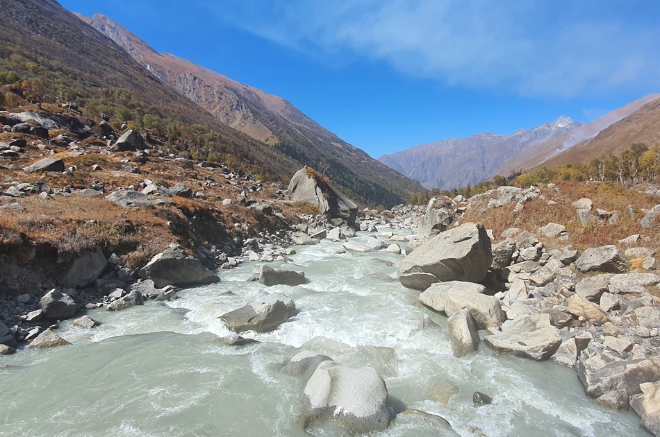
From here, the path drops abruptly until you reach river bed. It is slippery and filled with stones. Here you’ll cross another bridge. Admire the amazing sights all around you. The trail climbs steeply from this point. Rainbasera’s next campsite has one small hut. The gushing river is a beautiful sight to see in the evening. Trekkers often spend this peaceful moment right next to river bed boulders. Tents are a good option.

It’s an exciting day, as Ruinsara Lake is our next camping ground. It will be a similar trail to the one you saw yesterday. Continue walking for about 3-4 hours to reach the water body. The lake can be accessed by crossing streams, walking and other adventures.

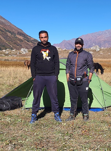
Camping today is a true dream. It is located between Ruinsara lake and Supin river, surrounded with meadows that are dotted by huge snow-capped mountains. The sky is dominated by the stunning Bandarpoonch range peaks like Kala Nag, Bandarpoonch and Dhumdhar Khai. Here you will also find a temple. You can simply walk around the area and take in the sights.

Today’s walk will only take you 4km. It descends towards the Supin river. You will pass through forests and cross rivers. The path climbs again before reaching the next meadow. The higher peaks can be seen from the meadows. This is a preview of the things you have seen in the last few days. Surprisingly the vegetation becomes sparser in the future. Odari is within a kilometre. Near the campsite is a rock cave.

Odari, which is a cave, was given the name. This cave is believed to have been the home of Bali, the brother of Lord Krishna. You can also see Swargrohini 1 and 2 clearly from this cave. Trek Leader will offer some training sessions after lunch that will help you as you climb higher.

Although it seems like a shorter day, it isn’t easy. It will be a steep climb up a 60 degree inclined path. This is a ridge-walk with loose rocks and scree. It is also difficult because of the stones that are scattered along the trail. You should get enough sleep and water. To avoid serious complications from height gain, you should take the necessary precautions. Nighttime temperatures tend to drop below zero degrees. Prepare for the cold. You can rest in tents after a long day.

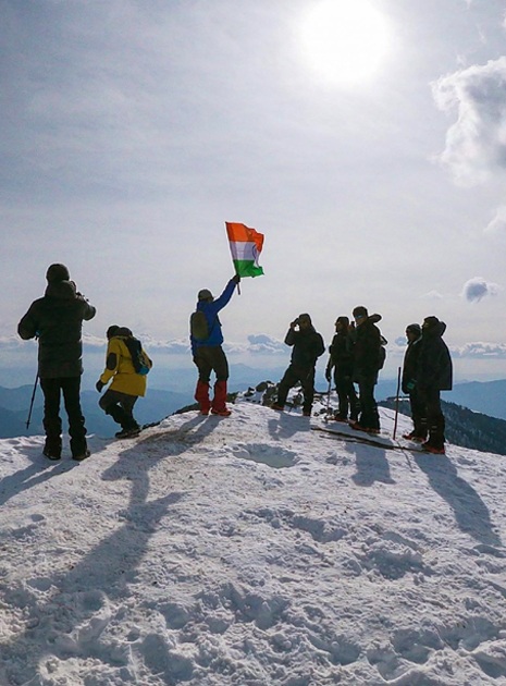
This can be considered the summit day. Today, you’ll be crossing the Bali Pass in order to reach Lower Dhamni. You will need to eat enough for the long day. The path to Bali Pass is steep and covered in snow. Follow the route marked by your guides. You don’t need to rope up, but you can wear microspikes if necessary.The summit of the pass is reached after a steep climb lasting between 2 and 3 hours. It is just 10 feet wide by 30 feet wide. This is the highest point where you can feel like you are on top of a mountain.

Enjoy the 360-degree views of Swargarohini and Banderpooch peaks. The Yamnotri Valley is visible to the right. Enjoy the view and take in the moment. Keep your eyes open for the descent, as the real thrill begins now. You will climb down almost to 90 degrees, following a narrow path. Follow your guide and use proper techniques. The path from the lower Dhamni to the upper Dhamni is very difficult so take care. You may find it difficult due to the snow.

Rest at Upper Dhamni after this difficult part. You will find the path from leg to Dhamni confusing. Follow your guide and make sure you are in a group. After some rest, we will begin our trek to Lower Dhamni. It is recommended to stick with your leader and team as the path can be confusing. From here, the trail will be flattened and easily visible. It runs for about 2 km through the forest. You can rest in your tents. You will be able to stay there for a long time.

It is the last day of the trek. This day will be the easiest, with a lot more descends than ascends. It is a cement-paved pathway. The climb up to Yamunotri takes another 1-2 hours. To reach Dehradun, leave early from your campsite.

Inclusion

  • Accommodation - Stay is included on all days of the trek . You will be staying in tents (3 per tent).
  • Food - All meals from dinner at Sankari on Day 1 to lunch included. Meals are simple, nutritious and vegetarian.
  • Trekking Equipments -All the trek equipment will be included like a sleeping bag, kitchen & dining tent, utensils, mattress, tent.
  • 4 season camping tent , Thermal rated sleeping bags & mattress.
  • Transport - Transport charges from Dehradun to Sankri and Return from Janki Chatti To Dehradun.


Exclusion

  • All kinds of personal expenditures are excluded
  • Anything that we have not mentioned above
  • The trek cost is not inclusive of meals bought during the journey on 1st day and last day (Food starts from dinner at base camp on day first till last day lunch)
  • Any kind of emergency evacuation charges
  • Rucksack Offloading Optional
  • Off Roading Charges Extra


Trek With Vagabondzz