Uttarakhand
Ali Bedni Bugyal Trek unlocks the magical world of endless meadows rolling under your feet as you crane your neck to absorb the beauty of the most impressive peaks of Garhwal Himalayas. On this trek, you won’t know where to look because there’s something unmissable in every direction.
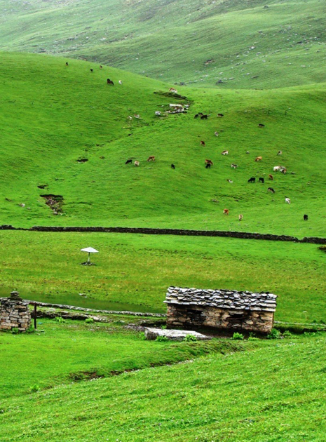
These twin meadows – Ali and Bedni have multiple personalities, changing at the turn of each season which truly makes it a year round trek. What season looks best on these handsome meadows, you ask? Well, they wear all the colours of each season with a lot of grace. The white of winter makes these bugyals (meaning ‘meadows’) shine whereas the bloom of wildflowers in the monsoons makes them beam with happiness. They wear the yellow of pre-winters with some rugged pride while in the summers they are a picture of warmth and abundance.
What’s even better is that the trek to Ali and Bedni bugyals is a beginner friendly trek for its humble altitude, friendly terrain and welcoming weather. Mt. Nanda Ghunti and Mt. Trishul wear a stern expression as they stand solid next to each other following you along all throughout the trek. You get the best views of these beautiful mountains from Bedni Top at 3,803M.
If you are driving with us, we begin our journey to Lohajung from ISBT Dehradun latest by 7 AM. It is located at a distance of 294 km from Dehradun and would take about 11-12 hours to cover. The landscapes throughout this drive are striking.
The journey begins with a drive uphill that takes us through the Kumaon region into the Himalayan Belt of Garhwal. The roads here are extensive and the Shivalik ranges can be spotted at the horizon. The setting is tranquil; the river accompanies you swiftly throughout this stretch.
The route via Dhanaulti takes us to Chinyalisour. As we drive through these quaint towns and villages of Uttarakhand, Raithal becomes visible from a short route towards Maneri after crossing the bustling town of Uttarkashi.It gets exciting from here on. We pass through three of the five iconic confluences of the Alaknanda river (Devprayag, Rudraprayag and Karnaprayag) on the way to Lohajung.
A beautiful showcase of tradition, Devprayag, is the first confluence we pass by. It is the converging point of the Bhagirathi and Alaknanda rivers. You can clearly see the turquoise of one merging with the teal of the other in the valley below.
Lohajung, located in the Chamoli district of the Garhwal Himalayas, is 86 km from Karnaprayag. Expect to reach Lohajung by late evening around 8-9 PM. If you are in need of any basic clothing or gear for your trek, you are likely to get it in Lohajung.
Tonight is in guesthouses; our last day of warm beds and hot meals before we leave for the trek tomorrow.
First day of our actual trek and we are going to one of the most beautiful campsites of the trek already – the jungles of Tolpani. We leave as early as 8 AM after an early breakfast. A 6 km drive on a bumpy road gets us to Kulling which is the trailhead of our trek. By 0830 AM we are all set to start our 7.5 km hike for today.
The day starts by going downhill for about 1.5 km, all the way to the clear waters of Neel Ganga. This 200M descend should take us 40 mins to cover. Once all the way down to the river, we cross over to climb the slopes on the other side. As you start to climb on this 400M long incline which brings us to Didna village, we see small hamlets stationed at the border of massive fields farming the red grain which goes by the name of Ram Dana and is a popular grain in this entire belt. On reaching Didna, we would have already covered 5 kms of distance for today and walked through stone-paved and dirt trails, oak forests and open lands.
We reach our very first campsite on the trail just in time for some hot snacks and piping hot tea which is perfect to balance the chill in the air.
Onwards to the first of the twin bugyals today, we start by around 09:00 AM after the sun hits our camp. We continue on the terrain like yesterday, zigzagging uphill through the thickly forested land. The incline takes us close to 200M up to a small patch of flat land. This respite is short-lived however, before we hit another patch of 200M incline with the rustle of the leaves under our feet, the smell of forest in the air and a faint glimpse of the mountain peaks on the other side.
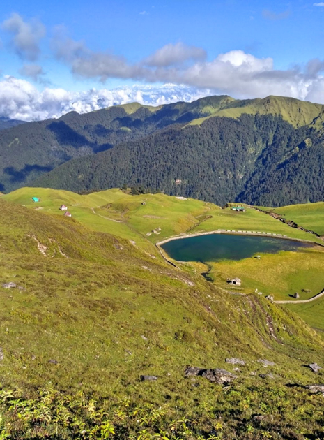
The campsite is three kilometers away from Gui Lake. Post reaching the campsite, we pitch our tents and cool off before we hike to Barnala Lake. This trail takes us through a densealpine forest and soft snowy high grounds that gradually lead to the lake.
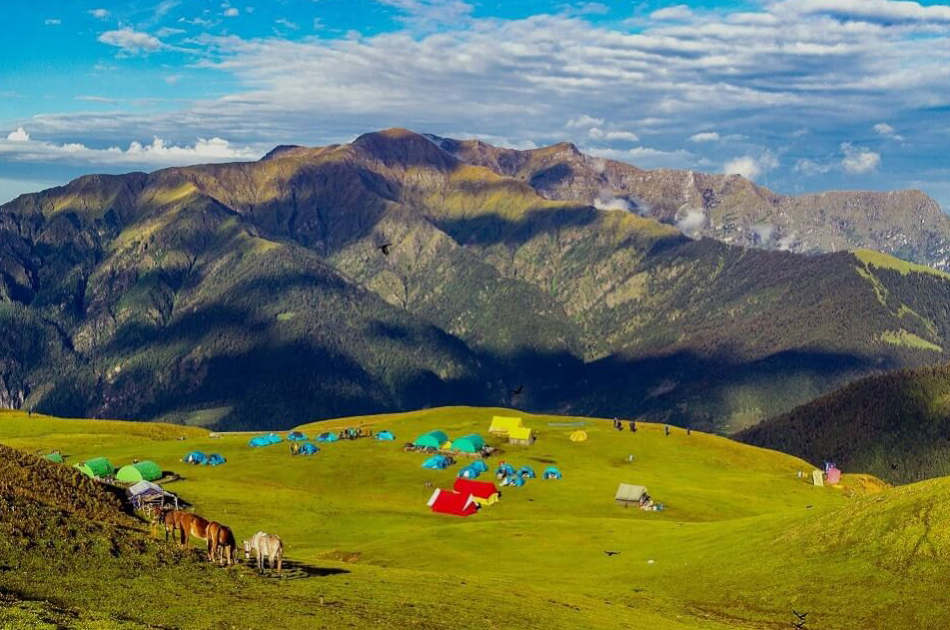
After the second patch of incline, the views suddenly open up and we are out of the forest as the rest of the world comes into view. Snow-capped mountains, the biggest of the Garhwal range, now stand tall to our left. Only small and fragmented patches of forest now. A hundred and fifty meters more, and the view opens up on both our sides with Trishul and Nanda Ghunti on one side and the rest of the range on the other including giants such as Chaukhamba. This is the start of the meadow. This is when we become fully aware of the expanse of the meadow as it spreads out far and wide in all directions around us. It is smaller humps from here on all the way to the campsite. The trail goes up and down on this open land with no respite from the winds knocking you silly from all directions – try to do your best to hold your ground!
The highest altitude we hit today is 3450M. The campsite is a 100M descent from here. The lower altitude provides a sanctuary from the wind by the way of being covered by a rock face on one side. With a total ascent of 650M for the day, expect to reach the campsite by late afternoon.
There are no water sources on our way today, remember to carry enough water from the campsite to last you the entire day.You have the rest of the evening to explore the land and the meadows we left behind.
After a mesmerizing introduction to one of the two bugyals yesterday, we head to our second climax today – Bedni Top which is also the highest altitude of the trek. We start early at 08:00 AM so that we can spend as much time on the top as possible.
We start off by climbing the 100M we descended yesterday to get to our campsite. This ascent brings us to the ridge from yesterday which we continue on for close to 300M uphill. This is gradual and pleasant. This should take us close to 1-1.5 hours. After this gradual ascent, we reach the base of the steep climb which will bring us to the best vantage point of the trek – Bedni Top.
A one kilometer hike to cover 210M of steep ascent is a bit strenuous but is only an hour long affair. If the climb didn’t, the view from the top is sure to knock the air out of you. With a small stone temple with lots of prayer flags as is the tradition of any mountain top, it is time to face Trishul and Nanda Ghunti head on. With their full face jutting out of the ground – it is the first time you feel the full force of these massive peaks as they stand unmoving right in front of you. Don’t be surprised if you find yourself glued to the ground, unable to move – these peaks have a way of doing that to you!
The wind here is free and untamed too, remember to cover up well. The descent down should only take about half an hour and we head back to our campsite after a full day.
There is no water sources on our way today, remember to carry enough water from the campsite to last you the entire day.
We have one more highlight before we end this trek. We start our day by around 08:30 AM after a wholesome breakfast. Since we are heading back down to our base village and losing altitude, today’s trek is mostly downhill on a stone-paved path through the enchanting oak forests. Within one hour of the trek, we start hearing the soothing sound of the river and 15 minutes from now, we start seeing it as well. It is only a matter of minutes before we are at 2620M and by the river side soaking our tired feet in its refreshing waters. We have already covered 2.5 kms for today.
Half an hour and a 150M ascent later, we reach the Rankandhar village which is at a vantage point to give you a view of small hamlets with step-farming fields stippled across mountain faces in all directions. The trail towards Wan village is full of Deodar trees. After 2 kms and a one hour descend, we are down to the trailhead from where we get our drive back to Lohajung to end the loop of this trek. It is a 40 minute drive at max to Lohajung where we will spend the night in the guest house. Expect to reach well in time for lunch.
After breakfast, we start for Dehradun at 9 AM. The journey once again takes us through the three confluences of Karnaprayag, Rudraprayag and Devprayag, only now, in reverse order. Expect to reach ISBT Dehradun by 8PM.
In case, you plan on traveling back to Delhi the same night, consider booking a bus that starts at around 11-12 PM to account for any delays we might encounter on the way.